Walken’
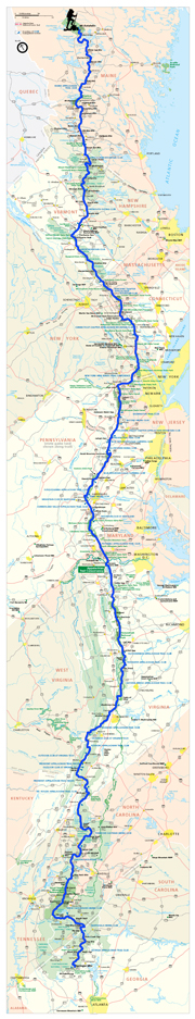
Powder River’s Appalachian Trail Journey from Georgia to Maine 2008KATAHDIN

I AM DONE!!!!!!!!!!!
Can you believe it? It is still strange to me that I have finished, and life is resuming as normal (but not quite). I am back in D.C. now, working in fact. I am catching up on all of my journal entries, as I have many to write going all the way back to Vermont. I’ll post them in order, and eventually get around to this exciting day, September 26 and the end of my journey. Please keep checking back at this site until you see all the entries, as I have many stories to share from New Hampshire and Maine!
Smarts Mountain

Day 147
Location: Smarts Mountain Firewarden’s Cabin, NH
Miles hiked today: 18.9
Miles from Springer: 1,757.7
Miles to Katahdin: 418.5
Elevation: 3,220’
I planned for some good miles today, so that I can make it to Glencliff in two days. I have to be careful with my time now, and I would like to time it so I am staying the night in Glencliff at the hostel run by Phat Chap, whom I had met at trail days. So it is either get there in two days, or in three. It’s about 40 miles away.
What is nice about this plan is it puts me on top of Smarts Mountain tonight, which has a fire tower. I love fire towers! My plan is to sleep up there, where I can catch both the sunset over Vermont, and the sunrise over the Whites. I understand this will be the last fire tower on the trail, and I don’t want to miss out. That means I should probably get there before sunset.
I am not in the Whites yet, which is the shorthand commonly used to refer to the White Mountains. The White Mountains are meaner, taller, rockier and more mountainous than anything we have seen yet on the AT. Their reputation intimidates even seasoned thru-hikers, and are the subject of much conversation from Springer Mountain on. You are not supposed to go into the Whites without winter camping gear, and people are killed every year in the Whites. It can snow any month of the year, and you should be prepared to turn around if the weather is not favorable. In other words, a lot of us have been looking forward to them for quite a long time. But not just yet. First, there is the 40 miles to Glencliff. First come the practice mountains.
At Moose Mountain Shelter, a hiker named Bilge Rat had perhaps his finest moment of genius. I have never met Bilge Rat because he has always been ahead of me, but he is a prankster who loves to leave very humorous practical jokes for the rest of us to find. They are always ironic, dry jokes that are best appreciated by those of us suffering through the various trials of hiking 2200 miles in cold, wet, hot, dry, snowy, steep, muddy, slippery and various other conditions. There was the fake electrified wire he put on one of the turnstiles back in Virginia, as some had actually been shocked by live electric fences when the trail makes you climb them. There was the water spigot he had bought at a hardware store, carried up the trail and actually bolted to a tree stump in the middle of the dryest section of Pennsylvania. There have been many more, but then there was what I found in the shelter. There, on the back wall was posted a four foot tall poster of a Big Mac. It had McDonald’s latest ad, “Two all beef patties special sauce lettuce cheese pickles onions on a sesame seed bun.” Of course the extremely detailed photograph showed the cheese glistening, the lettuce looked crispy and every sesame seed was in place. The nearest McDonalds is 140 miles away.
Near the base of Smarts Mountain is a gentleman who hands out free ice cream to hikers. You simply follow the very visible sign posted on the trail, which has a picture of a ice cream fudge bar. You come to the blue house which is about 50 yards off the trail, knock on the door and a guy comes out and gives you water and ice cream. Brilliant!! He says he does it just to meet interesting people. Indeed, I can imagine he does. He also lets you hang out on his porch for as long as you need.
On this particular day, I had a sunset to catch so I got moving. Smarts Mountain seemed taller than anything I had climbed in a while, and it was definitely steeper. I got to the top just in time for a brilliant sunset from the fire tower. There were already two southbounders planning to sleep up there, but that was ok because it was going to be a cold, windy night up there. There is a fire warden’s cabin, but because there wasn’t much space inside I pitched my tent outside with a view to the south. A guy in the cabin had a radio so we listened to Hillary Clinton’s speech at the Democratic Convention, the speech where she had to swallow her pride and throw in her weight with Obama. That, I thought, was an enjoyable speech.
Comments off
Ray Ray’s Cabin

Day 146
Location: Near Trescott Road, NH
Miles hiked today: 4.5
Miles from Springer: 1,738.8
Miles to Katahdin: 437.4
Elevation: 490’
Well this weekend really turned into a nice little vacation. Tailgate and I connected with Keychain, Zen, The Thinker, Cookie Monster, Spidey, No Amp and the famous Ray Ray. Famous because its her cabin, and she is the most fabulous host and cook that a hiker could ask for. She’s not a hiker, but a school friend of Spidey and No Amp. Did I mention she loves to cook? The cabin was back in Vermont somewhere, on a pond in the woods. It was quite a beautiful place!
I should also mention that Cookie Monster is actually a chef in a former life, and cooked up some mean stuffed peppers. There was much eating, sleeping, laughing, fooseball, pinball and even a heated discussion on prenuptual agreements. Ray Ray cooked and cleaned tirelessly, making a strong case for best trail angel status. We were there all of Sunday and most of today, as nobody really got up that early and there was much cleaning up to do. As there was just one car, we piled as many hikers and packs in as we could and Thinker droves us back to town in Ray Ray’s car. Instead of taking one zero, it was now almost two zeroes. Tailgate caught a ride down to Boston to visit his girlfriend, and I would not see him again on the trail. I learned later he was maybe just a day or two behind me at times, but I was starting to get worried about finishing the trail before my cut off date.
When I got back into Hanover, I went for another round of pizza at the place that gives free slices to hikers, and ran into my favorite crew; Freckles, Sprite and Papa Sarge. It really has been awesome to get to know these three, and it seems that every time I meet I am busy zipping ahead of them, never sure if I would ever see them again. They have really been amazing to get to know though, and I wish just once I could have the luxury of hiking with them for a good amount of time. It was not to be, however. They were looking to get transportation to the other side of New Hampshire where they had use of a condo, and planned on doing some slack packing. I was headed out of town on foot, so it wasn’t to be this time. Sprite did take down my plans for the next few days, and asked me what my absolute favorite trail magic was. I told her the thing I had dreamed about since Georgia was finding a whole bag of McDonald’s double cheese burgers with my name on it. It sure does pay to have good friends!!!
I eventually pryed myself out of the vortex that was Hanover, and headed for the outskirts of town. Just before the trail goes into the woods again is the grocery store, where I stopped to resupply. When I walked past the soccer field and towards the edge of the field, I once again ran into Freckles, Sprite and Sarge!! They were setting up camp. After a nice visit, we once again we bade farewell, and this time I would never see them again.
On my hike up the mountain I once again was struck with how truly different each state is on the AT. This definitely felt different than Vermont. There were a lot more firs, the mountains seemed somehow more alpine, and if I wasn’t just imagining it, I could have sworn the air was less humid, and more like out west. Maybe that’s because this state has some real mountains?? Maybe it was just the weather. At any rate, I am so glad to finally be in New Hampshire. I could live here!
On the way up the first climb I met a hiker named Lee, who can’t weigh more than 115 pounds. He is from Korea, and speaks no english. He has come all the way from Springer carrying a pack that looks to be about 115 pounds too. I love this trail.
Comments off
New Hampstah!

Day 144
Location: Hanover, NH
Miles hiked today: 10.2
Miles from Springer: 1,734.3
Miles to Katahdin: 441.9
Elevation: 520’
At last, I feel like I have come home. New Hampshire is kind of like a third home state to me, and my heart has long been attached to this place. I have done a lot of hiking in the White Mountains before, and it is one of my favorite places on earth. “Live Free or Die” is one of the most beautiful mottos of American history. To have walked here from Georgia is an incredible feeling, and now with just two states left it is indeed starting to feel like the end game. The mountains ahead are big, steep and exciting. The terrain is about to get more difficult, and the views more rewarding. To me, there is no better reward for hiking all this way.
But first, Tailgate and I needed to get to the post office. We woke up in a soup of wet fog, with tents drenched and lots of gear getting damp. We were in the White River valley, which we could see yesterday sunrise from the Lookout because the fog covered the entire valleys of both rivers. We packed up quickly; breakfast was calling.
The West Hartford general store did not disappoint. As I put down the big ‘everything’ breakfast, it occurred to me that my food bag was still mostly full, which I had carried all the way from Rutland. Oh well, nobody told me I wouldn’t need it!
10 miles is not that far to go in one day, but it is if you need to do it before noon. We were off by 8:30. There was nothing especially hard to climb, just some rolling hills between here and there, and as it turns out, an extensive road walk coming into Hanover. We passed over Podunk Road and Podunk Brook, and stopped for about 20 minutes to talk to a woman who was hiking southbound. We started to realize that we were out of time. Missing the post office would strand us in Hanover until Monday, which is never a good feeling. We started to walk faster.
The trail dumps out on Elm Street of Norwich, Vermont a full 3 miles before reaching Hanover. It turns out this was the hardest part of the hike, since it was hard, unforgiving sidewalk and blacktop. We stopped for a quick picture at the state line on the Connecticut River Bridge, and then started the double-time. We saw lots of hikers we knew at a pedestrian crossing downtown, only to wave and blow past them on a run to get to the P.O. We were now down to minutes. Falling behind, I let Tailgate run ahead and get a foot in the door. By the time I got there, the guy locked the door behind me. We were the last customers.
It was like Christmas. I had ordered a new tent and sleeping pad and had it sent here, so I opened it right on the sidewalk out front and unrolled it. I got a whole box of cold weather stuff, including my down jacket and cold weather sleeping bag. My pack instantly put on about 4 or 5 additional pounds. We set out in search of food, the outfitter and a computer. Laden with gear and wet tents, we decided to group up and get a hotel. Tailgate and I got a room with a hiker named Zero Zero, a name which also describes his vision. He is legally blind, carries a white stick, and has hiked here from Georgia.
Hanover is home to Dartmouth College, one of the Ivy League schools. This makes for a pretty interesting contrast of hikers and students in town. We hit up a pizza place that gave a free slice of cheese pizza to all thru-hikers, so it still seems to be a pretty hiker friendly place. At some point I picked up that the name of the state was actually New Hampstah, which I thought fit pretty well. It made me think of a giant hamster. While walking around afterwards, we ran into some friends, NoAmp and Spidey, who invited us to come out to a cabin where there was a huge hiker feed and general relaxation going on. Since they were going to be there all weekend, the decision was made to take a zero tomorrow. It is rare for me to actually know I am about to take a zero the next day, so this was a great sensation.
Comments off
The Hills of Vermont

Day 143
Location: West Hartford, VT
Miles hiked today: 18.8
Miles from Springer: 1,724.5
Miles from Katahdin: 451.7
Elevation: 390’
I woke up to the most spectacular sunrise I can remember. There had been no dewfall last night, and the sky was perfectly clear. When I opened my eyes I was facing the east, so the first thing I saw was the sky already turning pink. What a great place to sleep! I reached down and pounded on the roof with my fist to wake up the others downstairs, and started setting up my camera. There was low hanging fog clinging to the river valleys of the White and Connecticut Rivers, the Connecticut being the border of New Hampshire, and the 13th state of my journey, less than 30 miles away.
First order of business today was to get to a farm stand that was advertised being just .2 miles off the trail. Since there was another one just a bit farther down the trail, say 3 or 4 hours walk, we reasoned that we could hit the first one for breakfast and the other one for lunch, and then be in West Hartford by dinner. It was like we were back in New York all over again, but instead of monster deli sandwiches it would be homemade pies and jerky, and of course monster deli sandwiches. It is funny how some sections of the trail provide lots of places to eat, almost too many to visit all of them, and other sections don’t. I guess as a thru-hiker I can recognize a rare day when I see one, and take full advantage.
When we reached the road, there was already one other hiker hanging out there, waiting for the farm stand to open at 10 am. We had about an hour to wait, so we decided to walk over and wait on the porch. The place turned out to be much more than a farm stand. It’s called On The Edge, and the place was a full-on store full of locally packaged meats, jerky, cheese, honey, ice cream, locally made cola and of course homemade pie. Since we were early, we got to witness the vanload of fresh, hot pies pull up and get unloaded. I had a cherry apple, which was unbelievable. I also got enough food and Vermont soda to make me want to take a nap then and there. If there were ever a heaven for a hiker this place would be it.
We pushed on, eventually. This part of Vermont is a real treat to hike through, taking us up and down rolling hills, pastures, past farms, creeks with names like Gulf Stream and Barnyard Brook. We went through a section of maple trees that were fitted with taps for syrup, which at first seemed very bizarre as I had not seen anything like it before. Each and every tree was fitted with a plastic spigot with a grid of hoses running to each tree, stretching far into the forest. There were gentle climbs, views of rolling countryside and entire fields of wildflowers. At one road crossing, someone had put a bucket full of fresh zucchini and squash, with a note for hikers to eat them. (Admittedly, such things are not in my diet, even as a hiker)
Soon we arrived at the Cloudland Farm Country Market, which was actually just a farm, with a small store set up to sell ice cream, soda and jerky. They had a beautiful front lawn with a picnic table under a huge shade tree, and a hammock. If you needed something from the store, you knocked on the door to the house and someone would come out, unlock the store and sell you something. The weather was very beautiful; I would not change the temperature a single degree if I could.
Tailgate and I pushed on after a very nice break at the farm, still at this point aiming for the Happy Hill Shelter, which would take us to within five miles of Hanover, NH. We both have mail drops to pick up by noon tomorrow, and trying to race the P.O. at the last minute is never fun. There were still several ups and downs to go over, including one called Bunker Hill which had a brilliantly placed porch chair at the top of the mountain, with an unobstructed view to the east. Finally we came down onto some town roads and crossed the White River, which signified we were in West Hanover. (Later I would learn that it is popular for hikers to jump off this bridge into the water, which I have to admit is not a thought that usually occurs to me when I see a bridge). We planned on eating dinner at the general store, but missed it closing by about 5 minutes or so.
Tailgate noticed a benefit dinner that was going on this evening at some elementary school, and was suddenly animated by the thought of free food. We flagged down a car and asked where it was; only to learn that it was a half hour’s drive away. At this point we knew we were not going to make the shelter by dark. The driver of the car graciously offered his back lawn for us to pitch tents on, as long as we stayed out of view of his landlord who lived nearby. It turned out to be perfect, as it started raining within the half hour. Happy with our coup of finding a beautifully manicured lawn to sleep on, we couldn’t help but notice our fortune that we would wake up near the general store tomorrow morning, which is fabled for its hiker sized breakfasts.
Comments off
The Lookout

Day 142
Location: The Lookout, VT
Miles hiked today: 17.5
Miles from Springer: 1,705.7
Miles to Katahdin: 470.5
Elevation: 2,320’
Today was an awesome day to be hiking the trail. I started the day in what has possibly been my favorite trail town so far, Rutland. I had an amazing breakfast, on the house and courtesy of Ranan and his staff at the hostel. He and everyone I met here were incredibly nice and really made my stay special. Ranan handed me two energy bars before I left, which were not ordinary energy bars. They were very dense green bricks of mystery ingredients, made in-house and wrapped in saran wrap. They taste just like peanut butter cookies and give you a sensation of having just guzzled hiker rocket fuel. As he handed them to me, Ranan said, “You’re going to eat one of these, and then you’re going to climb a big mountain. When you get to the top, you’re going to think to yourself, I have to do that again.” I couldn’t have put it better myself.
I caught the morning bus out of Rutland, which took me directly to the trailhead for 2 bucks. The bus stop is literally out the back door of the hostel, and is part of the city public transit system. See, I told you this trail town is awesome. Very soon I was back on the trail, but faced with immediate options. This part of the trail has recently been re-routed, and now goes no more than within a mile of the storied Long Trail Inn. It is a place that has been highly recommended to me, however because it was still morning I thought better of it. I was full of food from Rutland, and if I didn’t eat what was in my pack, then my pack would never get any lighter. Besides, I could save the Long Trail Inn for when I do the Long Trail, right?
At a place called Maine Junction, the Appalachian Trail splits off to the east towards New Hampshire, while the Long Trail continues north to Canada. The AT and the LT have been the same trail since the Massachusetts border, but no more. All of those Long Trail thru hikers, still green and working through their first blisters and what gear they should be carrying will hopefully figure everything out before their trail actually ends. As for us AT hikers, the best is just about to start. There is nothing but beautiful and picturesque rolling hills through the rest of Vermont, and then the storied White Mountains.
I stopped for snacks at Gifford Woods State Park, correctly guessing that they would have flush toilets and vending machines. Turns out they have Ben and Jerry’s ice cream as well, so I was well rewarded. No sooner was I back on the trial then I was confronted with yet another temptation and potential mileage killer. The Mountain Meadows Lodge at Kent Pond has an absolutely beautiful property on the edge of the pond, and supposedly they serve lunch. Using the same logic as I applied to the Long Trail Inn, I hiked on. As I would learn later, this was regrettable because not only did I miss out on some killer, cheap food, but they have a pot bellied pig named Alice, that will pose for photographs.
At the Stony Brook Shelter I stopped to sign the register and see how many mosquitoes I could kill in a given period of time. Soon a hiker named Tailgate arrived, who seemed to be aiming for about the same distance I was for the day, the Wintturri Shelter 10 miles away. It was afternoon now, but both of us had packages to pick up at the post office in Hanover, which was still 35 miles from here. This being Thursday, and the post office closing at noon on Saturday, this meant that once again I am racing the post office, which is fast becoming one of my least favorite pastimes on the trail. Happy to have company, I set off with Tailgate.
About a mile and a half before the shelter is a place called The Lookout, which I had heard a lot from south bounders. Basically, they had said whatever you do, don’t miss this place. When we arrived, I soon figured out why. The Lookout is a vacation cabin built on a very prominent knob with a 360 degree view, including our first good look at the Whites to the northeast. It only has one level, with a barn-style loft inside, yet with an a-frame roof the top of the building is about 2 stories up. They have built a ladder, and a small deck platform on top of the roof, which provided what turned out to be the best perch I had during the whole trail. Inside was a hiker log book with the first page signed by the owners of the cabin, basically given us permission to stay there.
Up on top of this perch, chilling out in a cotton t-shirt was a local and former thru-hiker named Freebird. He had hiked the AT twice, and now lives up in this area. Freebird has an incredible memory for terrain and places, and seemed to know every single peak within our view. It was most fortunate that he happened to be up there when we arrived, as he gave us the best tour anybody could possibly give, pointing out every single peak in 100 miles in all directions that we could possibly see. It was an impressive display of memory, but even more made me appreciate this place so much more. We could see the White Mountains of New Hampshire to the northeast, which everyone was so eagerly anticipating. Mt. Washington kind of disappeared in the haze of Franconia Ridge in front of it, but we could clearly make out Mt. Cube, Smarts Mountain and Mt. Moosilauke. To the north we could see the entire second leg of the Long Trail until it reached the Canadian border, including Mt. Mansfield and the Camel’s Hump. Freebird pointed to some distant, faint peak a little to the right of this line, and declared that was a peak in Canada. We could see into Canada!!! To the west we could see all the way to the Adirondacks of New York, and to our south we could make out peaks that were actually in Massachusetts! We could not see Greylock, as Stratton Mountain obscured anything that was south of it on the AT. As all of this started to sink in, Freebird pointed out that it was about 200 miles on the trail from Stratton Mountain to Mount Washington, which means from a single place we were looking at one tenth of the trail. Freebird thought that this rivaled even the view from Mt. Washington or Clingman’s Dome, as from here we had high peaks to mark the farthest points, instead of standing on one. The unique placement of the lookout allows this, as there are no peaks nearby that are too tall to obscure the view in any one direction. Not only were we taking in one tenth of the trail, but we could see four states plus Canada!!!
Our thoughts of pushing on to Wintturi Shelter long forgotten, we set up camp. A few other hikers showed up, and I ran and got my sleeping mat and staked my claim on the roof. It was a really incredible sunset, and even the moon was impressive as it rose a fiery orange. It would be one of the most incredible nights I had on the trail, sleeping under the stars 30 feet off the ground on a small platform, knowing I would awake to the most incredible sunset I could imagine over the White Mountains.
Comments off
Killington Peak

Day 141
Location: US 4 (Rutland, VT)
Miles hiked today: 10.7
Miles from Springer: 1,688.2
Miles to Katahdin: 488
Elevation: 1,880′
I was really glad I didn’t climb Killington last night. It got rather cold last night, dropping to around 40 degrees in the valley. My sleeping bag is rated to 45 degrees, so I was definitely testing the limits of it. On top of Killington, it would have been another 10 degrees cooler, with high winds.
The climb was no picnic, but was very beautiful. The forest has truly turned to an alpine environment, and I could have easily been hiking through the Big Horn National Forest in Wyoming, just looking at the trees. Killington is the second highest mountain in Vermont, and the highest that the AT climbs in Vermont. (Mount Mansfield, the tallest, is farther north after where the AT turns east for New Hampshire.) Killington is also a huge ski resort, possibly the most respectable one east of the Rockies.
The shelter I would have stayed at last night at the top of Killington is basically a run-down park ranger cabin with all the windows broken out. There were a lot of big windows, so basically the entire west facing wall is open, which happens to be the windward side. I got there at about 10:30 in the morning, and it was freezing cold inside. I am definitely thankful for the secret shelter last night, and glad I didn’t stay here. There was also a quarrelling family occupying it, who were still in bed when I got there and would have made for a long night of listening to two little kids fighting with each other and the mom counting to three every 10 minutes.
The AT does not go to the summit of Killington, but rather just past and below it. There is a quarter mile summit trail you can go up, which is possibly the steepest incline I have seen yet; it goes practically straight up. I dropped my pack and clambered up.
The view from the top was spectacular. This is the only place in Vermont on the AT that you can see off a mountain without climbing a fire tower, and there was a really great rock slab with a 180 degree view. It was extremely windy up top, but of course I enjoy cold mountaintops (as long as I’m not sleeping on them) and it was just a nice place. The Appalachian Trail makes a turn to the east just a few miles to the north, while the Long Trail continues towards Canada. Looking to the northeast I could make out some very distant and tall mountain ranges, which I guess would be the White Mountains. To the north, I could see what was probably the rest of, if not most of the rest of the Long Trail.
I followed a path off the back side from the viewpoint which led to the ski lift and lodge. The gondola was operating, and every so often a guy on a mountain bike would get off and go tearing down the mountain. Every run going down from the lift was either a black diamond or a double black diamond, so I would guess that these guys are collected in a heap somewhere far below and sent to area hospitals. I can guarantee that if I tried that it would be my last time riding a bike, or even walking for that matter. The lodge was nice for a ski lodge, and they even sold food for outrageous prices. The guide book actually says that the prices are adjusted to match the altitude. I decided it was time to be getting back to the trail, so I could get into town.
The trail down to the highway was only six miles, but seemed a lot longer. It was just a long, gentle downhill that never seems to really drop in elevation, and all the while you get glimpses of the highway to the left which still seems too far below. At the very end it actually goes up several hills just for good measure, so by the time you get to the highway you are not quite sure you trust that you are actually seeing it.
Rutland is 11 miles from the trail, therefore necessitating a hitchhike. Because it is so far off trail it is not a town I thought I would be stopping at, but the highway goes straight there and most people travelling it are probably going there. I have been hearing a lot of good things about Rutland, plus they have food! Like all things on the trail, you can plan all you want, but if there is fast food in that town, it doesn’t matter how far away it is.
After sticking my thumb out for about a full minute, I got picked up by a former thru-hiker named Creeper, who told me an incredible but true story about when some hikers found a dead guy in one of the rooms at the Doyle Hotel in Duncannon. I had heard the story before, but Creeper was actually there and provided a detailed account, much of which I had never heard before. The Doyle dead guy story will truly go down as one of those legendary tales of the AT. I made a mental note not to stay at the Doyle next time I’m in Duncannon.
I checked into the hostel in Rutland, which is run by a religious community called the 12 Tribes. I never did quite figure out what they worship exactly, but my impression is that they are Old Testament centered Christians. At first I thought they were Jewish, because they all take Hebrew names. But then I saw that they study the gospels, which left me wondering. No matter though, because the bottom line is they are incredibly nice people, and run one of the best hostels on the trail. They don’t try to push their beliefs on anybody anyhow. This was one of my favorite places I have stayed at yet. They run a cafe downstairs, which has really amazing organic food that they grow on their own farms. They serve mates, which are house recipe teas that are absolutely addicting. As a thru-hiker, I signed up for work for stay, which meant that I got a pizza dinner, breakfast, unlimited mates and my stay was free in exchange for helping out in the kitchen. This place is really making a strong case for me taking a zero tomorrow.
Comments off
The Super Secret Shelter

Day 140
Location: Swan Song Shelter (Super Secret Shelter), VT
Miles hiked today: 14.5
Miles from Springer: 1,677.5
Miles to Katahdin: 498.7
Elevation: 1,800′
I started out this morning climbing Bear Mountain for the third time. Apparently someone who names these things has a sense of humor, as I have now climbed Bear Mountain in New York, Connecticut and Vermont. It really was easier the third time, although that is just because this is the shortest of the three. I still didn’t see a bear on Bear Mountain, so I am really considering asking for my money back.
The trail crosses a really impressive gorge with a swinging suspension bridge, with a sign warning that the bridge can only support one person at a time. The sign is only found on one side of the bridge, so I guess if you are a southbounder here is an added hazard for you. (Maybe they are trying to send a message to you, such as you are going the wrong way?) I found out much later that this entire bridge had just been rebuilt by some friends of mine on the trail participating in a Bob People’s Hard Core trail building project. My friend Bigglesworth actully hung from a harness under this bridge and put all the bolts in!! If I had known that maybe I would have found a different way across, and this also explains the sign about the weight!! (Oh, you know I’m kidding Bigglesworth. I trust your construction skills 100%.) The water below is a fast, angry river that looks like something only professional kayakers would attempt. Yet my guidebook says it is a favorite swimming hole for residents, and it also says to be careful of broken glass. Finally, it casually mentions that the bridge is named for someone who drowned there. This whole thing is fishy to me, and I’m starting to think they are trying to cut down on the number of us hikers!
I was hiking off and on with the “Triforce” today; three guys from Florida consisting of two brothers and a friend, plus the friend’s brother making four. We came upon some trail magic in the woods; a cooler that turned out to be empty. It is a hard fact of the trail that when you see a cooler in the woods, despite your soaring hopes for an ice cold Coke it could very well be empty. Instead you paw through empty cans and other trash, looking for that one unopened can that someone may have missed. Your hopes are dashed in the end, as the reality sinks in that the nearest 7-11 is 17 miles further up the trail.
While sitting there recovering from disappointment, a different kind of trail magic came along. A woman and an extremely elderly man came down the trail, and she asked us if we knew about the secret shelter. We did not, and so she showed us how to get to it. Now I had been comtemplating pushing on to the top of Killington Peak, which is another 4.5 miles on and is a big 2200′ climb. There was another shelter about a mile from here, but word was that it was really trashed and locals sometimes visit it to harrass the hikers. The book says not to stay there.
So, a secret shelter that is closeby definitely settled the matter, and we quickly found the side road that leads to it. The shelter is called the “Swan Song Shelter,” and was put up on private land by the people who own the house nearby to it. They built it at their own expense, and the guy who built it makes log cabins for a living, so the craftsmanship was really amazing. The shelter has hand-fitted joints to join the logs, and not a single nail is holding it together. It was fitted out with candles, a wiffle ball bat and even a big red button that read “push to activate hot tub.” (A prank, of course).
The most impressive part of the secret shelter was the privy. Made in the same high quality craftsmanship, the building is rounded, with a curved door that when closed perfectly fits the curved lines of the building. Inside is a very nice finished wood throne, and a huge skylight in the ceiling. The finishing touch was a coffee table book entitled “Outhouses of New England” that was a pictorial tour de force of great outhouse architecture in the northeast. It was so nice you just kind of wanted to hang out there for a while.
This place is definitely a jewel. Soon some more hikers showed up, and the shelter filled. It got very cold in the night, and for the first time since carrying my summer sleeping bag (since Damascus, Virginia) I was feeling a little chilly. It is almost time for the 20 degree sleeping bag.
Comments off
I’m going to race Karl Meltzer to the finish

Day 139
Location: Greenwall Shelter, VT
Miles hiked today: 21.6
Miles from Springer: 1,663
Miles to Katahdin: 513.2
Elevation: 2,025′
Somewhere this morning while climbing Peru Peak I passed Karl Meltzer, who is attempting to break the speed record on the Appalachian Trail. His target is 47 days for the whole thing, and he is running the trail and covering around 50 miles a day. He left Katahdin about 2 weeks ago. He is sponsered by Backpacker Magazine, has a support team in an RV with his name and web page plastered all over it that meets him at every road crossing, and he doesn’t carry a pack. I did hear a story from someone who actually met Karl at his RV, and asked him what he thought of the trail. Karl leaned in close and said, “It’s easy.” I do believe I would have taken off my pack right there and handed it to him, and tell him to try it out for 20 miles.
I don’t really care how he hikes, -or runs- the trail. It would be nice however, if he didn’t beat me to the finish. I passed him with around 513 miles to go to Katahdin, while he has 1,663 to go to Springer. Karl, you and I are in a race!
Today was another day of long miles. I went swimming at a place called lost pond, aware that swimming opportunities may get scarce as I head north and cold weather approaches. There is a camp site there at the pond, but I had a few more miles in me so I pushed on. The last four miles seemed to last forever. The trail climbs White Rocks Mountain, which at first does not seem like it would be a big deal, but a 650 foot climb at the end of a very long day can be tiring.
At the top of White Rocks, I believed I discovered the reason for the name. There was a formation of rocks on the left, and stacked on top of these were hundreds of loose white rocks, arranged almost as rock sculpture art. There were even little white rocks stacked on the branches of some of the trees. Someone has obviously spent a lot of time on this.
Finally arriving at the shelter, I discovered that there were quite a few people there already. Looking at the available tent sites, each of them had a looming dead tree above. After nearly dying in Connecticut from a falling tree, I didn’t like this much, but needed to choose a site anyways. I set up under the sturdiest looking one.
I had just finished cooking my dinner when the first peals of thunder crashed, and the rain opened up. I raced to my tent with my dinner in hand, and ate inside. My tent is gracious enough to let some of the water through its fabric, so I don’t miss out on all the rain. I was in for a damp night, as I kept needing to wake up periodically to kick the accumulating rainwater off the foot of my tent where it collects by the liter. It was a real nasty storm, and I’m pretty sure the rain fell all night, and the thunder was frequent. On the bright side of things, I did not wake up with a tree in my tent so I guess someone upstairs was looking out for me.
Bromley Mountain

Day: 138
Location: Bromley Mountain Ski Patrol Hut, VT
Miles hiked today: 13.6
Miles from Springer: 1,641.4
Miles to Katahdin: 534.8
Elevation: 3,260′
I managed to make a successful in-and-out visit to town today, which is virtually unheard of in the thru-hiking world. Each town has a gravitational vortex consisting of grocery stores, convenience stores with slurpies, cheeseburgers, and laundromats that usually combine to overcome any hiker’s best intentions of leaving town. On this occasion however, I was able to overcome all of these factors and claim victory over the yuppie shopping town of Manchester Center.
I did about 11 miles this morning to get to the road, making pretty good time. I got a ride very quickly, giving me great faith in Vermonters. The lady even took me all the way into town, even though she initially said she could only give me a ride part way. I soon had my clothes in the washer and was scarfing down 4 double cheeseburgers off the value menu before I had even been in town a half hour. There was an Eastern Mountain Sports store that had some socks I needed, but the local outfitter is way better. They replaced a bent section of my Leki pole for free, and the guy was pretty nice. This was really turning into a record town stop.
When I came out of the grocery store with my food, I was approached by an older gentleman named Joe who said he could take me back to the trail for $10. This sounded pretty good to me, since the trail was more than 5 miles away. A French Canadian hiker named Torch, who is hiking the Long Trail, decided to ride too, and we talked Joe down to $15 for both of us. Joe drives a very nice Cadillac, and he’s installed some very cheesy noises in his car, such as a beeping when the car backs up, and a train whistle when he blows the horn. We were definitely riding to the trail in style.
I was back at the trail by 5 p.m. or so, which made for an unheard-of 4-5 hour town stop. I had clean clothes, a full food bag and a stomach still hurting from my binge eating at McDonald’s and Ben and Jerry’s.
The shelter was only about a mile and a half up the mountain, but I had learned from a southbounder that there was a ski patrol hut on top of Bromley Mountain that hikers could stay in. Those southbounders may be walking the wrong direction, but they sure do turn out useful sometimes.
The weather was threatening, so I hurried on past the shelter to get to the top before it started raining. The trail goes right through a ski area, and even goes right up one of the ski runs to get to the top.
There was a ski lift at the top, the ski patrol hut and an observation tower. There was only one other hiker in the cabin, who was a southbounder. We had the place to ourselves, and the nice thing was the cabin was insulated very well for winter use. The place even had a working phone, and there was a note from the ski patrol asking the hikers to please stop pooping in their storage shed, as it is not a privy!
The best part about the place was the fact that it’s on top of a mountain, and there’s an observation tower. The sunset tonight was phenominal, even better than the one two nights ago! It was another stunning 360 degree view. I was starting to forget about Vermont’s muddy first impression, and I have to say, the Green Mountains are growing on me!
")

")
")
")
")
")
")
")
")