Walken’
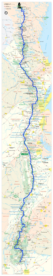
Powder River’s Appalachian Trail Journey from Georgia to Maine 2008Archive for Massachusetts
Mt. Greylock

Day 133
Location: MA Rt. 2 (Williamstown, MA)
Miles hiked today: 14.6
Miles from Springer: 1,579.9
Miles to Katahdin: 596.3
Elevation: 660′
I finally met Father Raymond in the morning. It was his chuch, St. Mary of the Assumption where I was staying. It was a truly wonderful place to stay, and in my case, a very timely one so I could dry out. Someone from the congregation stocks some food in one of the hiker rooms, and I could not believe my eyes when I saw it. It was a full bookshelf filled with all kinds of hiker food, as if it were a fully stocked store. What great people!
I got going a little after 10 a.m., finally on my way up the slopes of Mt. Greylock. It is the highest point in Massachusetts, and it looms large for a northbounder because it is the tallest mountain since Virginia, and the first one over 3,000 feet since the Shenandoahs. I was looking forward to climbing a real mountain.
Predictably, it started to rain again. Massachusetts has been really unkind with the weather, as it has been cold and rainy almost every day here. That has also meant a whole lot of mud, which means wet and muddy shoes and does not help matters. Some of the southbounders I have passed have said it has rained every day for a month for them, and they have seen nothing but mud. One of the locals told me that the jet stream has parked in an unusual place for this time of year, bringing cold air from Canada and continuous rain systems. I just hope this lets off soon, so I can get some nice weather.
Just like yesterday, I got soaked through in just a few miles, despite my rain jacket. It is doing a fine job of stopping water from coming in, but I am also sweating so I get wet either way.
It was a really beautiful climb, with lots of very beautiful forests. Massachusetts really does have exceptionally beautiful forests, which are distinctive from the rest of the trail. There are a lot more fir and hemlock trees, mixed with birch and hardwoods. There is a lot of areas covered with pine needles rather than extensive underbrush, which I love. There are also a lot of ferns, which you don’t find out west.
By the time I reached the top, I was cold and wet, and would have appreciated someplace dry to eat lunch. But the lodge was closed for renovations. I ended up huddled under a small overhang of roof, near one of the entrances of the boarded up lodge, quickly eating what I could before moving on.
The summit was fogged in, which was too bad because it is supposed to have really great views of the area. There is a giant war memorial monument at the top, of which I could only see the first 30 feet of because of the fog. It was still raining, so I took a quick picture and moved on.
Before leaving the summit area, I came across Thunderbolt Shelter, which is an emergency shelter for hikers and skiers. It was just what I needed; it had 4 walls, a roof and a door, and even windows. It allowed me to dry out some, and eat a proper lunch. There was a guy hiking with his son, who looked to be about 8. The kid was actually carrying his own gear, which I thought was pretty cool.
I was glad I stopped for lunch, because I was rewarded with the sun coming out. For a fleeting moment I could see the top of the war memorial, which had a huge glass globe on top and looked like something out of Jules Vern. I walked back up to the summit and got some pictures, and by the time I got back the fog was back.
On my way down, the sun came all the way out, and most of the clouds disappeared. It turned into a really beautiful day. I stopped at an overlook that had a breathtaking view of Williamstown and the valley below. I was in good spirits as I descended the rest of the way, looking forward to my third town stop in as many days.
Anyplace Dry

Day 132
Location: Cheshire, MA
Miles hiked today: 8.7
Miles from Springer: 1,565.3
Miles to Katahdin: 610.9
Elevation: 950′
I hung out in town maybe a little longer than I should have, but leaving late had the effect of cutting my miles down, which in the end was a good thing. I had intended to go over Mt. Greylock today, and stay at a shelter which is on the other side of the summit. Instead, I opted to hang around Dalton until the library opened at noon. As I was walking to the library, Mountain Squid pulled up in his truck, and another hiker named Dal-Wa-He was inside. They were going to the big shopping center with the supermarket and a Taco Bell. My mother didn’t raise any dummies! I hopped in!
After returning from the store and going to the library, I was finally ready to leave town. It looked like my hike today was going to be short indeed, as it was almost 3 p.m. The next town, Cheshire, was only 9 miles away so I decided to go there. I stopped at the convenience store to fill up my camelback with 2 liters of slushie, which has been a dream of mine ever since New Jersey. Y2K would be proud. I went with the “grape grenade” and “cherry blast” combo, which was pretty tasty. The ony problem with the whole scheme is that I picked one of the coldest and wettest days to do it – an oversight that would do me ill later on in the day.
When I had just gotten out of town, it started to rain. This time it was much heavier than before, and despite my rain jacket, I was still soaked to the skin. The temperature is unseasonably cool, and I could not stop for even a few minutes or I would get very cold. I was very thankful that I didn’t put in a long day of hiking today, as I would have been up on Mt. Greylock at about this time instead of coming into a nice, warm town.
The hike was short and I was soon on the streets of Cheshire, which is perhaps the sleepiest little town on the whole trail. The problem seemed to be that there were no people. Sure, there was a car or two driving around, but nobody seems to live in these houses or own any businesses that would be helpful to a wet, cold hiker.
I tried the Catholic Church which supposedly puts up hikers for the night, but there was nobody there. This was not good, because I needed to get indoors before I caught hypothermia. I wasn’t so cold that I couldn’t appreciate the irony here. It wasn’t going to be on the slopes of Greylock or any other tall mountain that I would succumb to the elements, but right here in the streets of Cheshire, with my camelback filled with ice cold slushie!
I nearly hopped on a regional trainsit bus to the next town, but the driver said I should try the market which was down the street. It is when I stepped out of the bus that I saw it, gleaming in the driving rain like a Jello Pudding Pop on a hot day – a pub! Not just a pub actually, but also a pizza place. I could not have invented a better place to get warm and dry than such a place.
So it all ended very well. I became warm and dry with the help of Sam Adams and a huge pile of nachos (called the Appalachian Trail Nachos, that drew oohs and ahhs from the other patrons when it came out of the kitchen). I still did not have a place to stay, so I decided to go back and try the church one more time. There was still nobody there, but I tried the door to the fellowship hall and it opened. There was already a hiker there, already asleep actually until I woke him up. There were two hiker rooms, so I took the other one and had a wonderfully dry and warm room all to myself. I spread out all my stuff to dry and soon forgot what it was like to be cold and wet, and that slurpies are a bad idea on such days.
Comments off
Blueberry Mountain

Day 131
Location: Dalton, MA
Miles hiked today: 20.6
Miles from Springer: 1,556.6
Miles to Katahdin: 619.6
Elevation: 1,200′
It was a very beautiful morning with a clear sky, and for some reason I was up earlier than usual. Everyone in the cabin was up, actually. My guess is they were anxiously waiting on the pancakes. I went outside and went down to the lake, which I did not get to do last night. There was a mist hanging over the lake, and the water was like a mirror. It was a perfect morning for a swim.
The pancakes were phenominal. I grabbed a seat at the table, right next to where each batch of pancakes was set as they came out of the kitchen. It is very possible that I got more pancakes this way, unless I am mistaken. The coffee was really good too, which of course was also right in front of me.
This cabin looked like the perfect place to take a zero, but I needed to move on. I did want to take full advantage of it, so I decided to leave late. There are lots of comfortable chairs, both on the porch and inside. I lounged most of the morning, catching up on my writing. I was finally getting ready to go when I realized it would be very nice to take the canoe out for a spin on the lake. The caretaker, Peggy, brightened at this because there was a certain chore that can only be done by canoe, and that is fetching water. I had just volunteered. The water source for the cabin is a spring across the lake. Today there were 16 empty gallon jugs that needed to be filled and hauled back to the cabin. It was kind of nice to put in some work, as the cabin is supported by donations and the caretaker has to do any work that the hikers don’t volunteer to do.
Finally on the trail, I soon crossed the Massachusetts Turnpike or I-90 on a footbridge. It is mind-blowing that I have walked this far north. This road would take me to my home town of Sheridan!
At a road crossing I stopped at a bed and breakfast to make a phone call, and while I was standing there some people who live there handed me a hot dog. The guy doing the grilling then cut me off a piece of his steak, and his son brought me a Pepsi. I love trail magic! This turned out to be just the thing I needed, as I had a lot of miles to do yet.
I was trying to make it to Dalton, which was still about 20 miles away. Setting off at noon, I wasn’t getting off to a great start. It started raining, and the temperature was dropping. I needed to keep moving if I wanted to stay warm. Thankfully this section of the trail is relatively flat, with no high mountains and lots of lakes and ponds. It is a very beautiful section though, so it was a nice day, even with the rain.
I came to a road where there is a house where the “cookie lady” lives. She lives on a blueberry farm, and welcomes hikers to come and have blueberry cookies, and to pick fresh blueberries. To my disappointment, nobody was home when I got there. Little did I know, the trail had something better in store for me.
Earlier in the day I had met a southbounder who told me how great of a view Warner Mountain has. He said you had a view to the north looking towards Mt. Greylock, which I hadn’t seen yet. I was disappointed it was raining, because it meant I probably was not going to get a view.
When I got about a half mile away from Warner Mountain, the rain stopped. Then, suddenly the sun started to come out, and the forest took on a whole new glow with the additional light. There were drops of water on every leaf and flower, now lit brilliantly. This is one of my favorite times in the forest, just after the rain stops.
I came to an overlook, and was presented with a panoramic view of Mt. Greylock and the surrounding ranges. The clouds were just parting, providing an amazing view. Then I looked down and realized I was standing next to the biggest and most heavily laden blueberry bush I had seen yet. There were hundreds of large, ripe blueberries there for the picking. Looking around, I saw dozens more blueberry bushes! I had stumbled into blueberry heaven. I started eating them by the handful, only pausing to take some pictures of the view. I ate until I was full, my hands and mouth smeared purple.
Comments off
Upper Goose Pond Cabin

Day: 130
Location: Upper Goose Pond Cabin, MA
Miles hiked today: 21.1
Miles from Springer; 1,536
Miles to Katahdin: 640.2
Elevation: 1,483′
The weather was perfect today. It was cool, and did not rain, which made it perfect for hiking. I did not see any other thru-hikers today, although I saw a few people out for short hikes. It was a day of solitude. There were several beautiful ponds and lakes. I stopped at one called the Beaver Pond for lunch, which had several dead trees still standing in the middle of the pond. Presumably, it was once a meadow, before being dammed by beavers.
Today was also a long and uneventful day. I got going a little late in the morning, so I didn’t get in until late in the evening. The real highlight of the day was the cabin. Upper Goose Pond Cabin is run by the Appalachian Mountain Club, and provides bunks for hikers, as well as a pancake and coffee breakfast in the morning. It is a beautifull building situated on the bank of a really great pond. You can take the canoe out on the pond, or go swimming. There is a caretaker who lives there as well to make sure everything runs well and gets cleaned up. The cabin also has a very nice library of books.
The cabin is a half mile off the trail, but I was very glad to be staying here. I slept well, dreaming of pancakes in the morning.
Comments off
Shay’s Rebellion

Day: 129
Location: Tom Leonard Lean-to, MA
Miles hiked today: 14.4
Miles from Springer: 1,514.9
Miles to Katahdin: 661.3
Elevation: 1,540′
It had rained all night, leaving a clear and beautiful day. I always sleep really well during rain storms, and this was no exception. The spring at the shelter which had been dry last night was now flowing steadily.
As I came off the mountain, I was introduced to what would be the main theme of the trail in Massachusetts; mud, swamps, and mosquitoes. The trail goes through a lowlands area between two mountain ranges before going up again.
At one of the road crossings is a monument I was quite excited to see, which is the Shay’s Rebellion monument. Daniel Shay was a Revolutionary War veteran who had served proudly. However, he was like most soldiers in the Continental Army who were often not paid because Congress had no power to tax the colonies, and no money to pay or even adequately equip the army. While he was away fighting, his farm was suffering and eventually went under, and he went into debt.
Back then, they put you into prison for debt, and in the years following the Revolution, there was an epidemic of veterans going to prison, as many of them were in very similar situations as Shay. The weak federal government under the Articles of Confederation could do nothing about it, and could not even raise the money to deliver the pensions that had been promised. Add to this a failing economy and wild inflation among the 13 different forms of currency, one for each state.
Shay raised an army and led an uprising in western Massachusetts, which culminated in Congress sending an army of their own to quell the rebellion, led by Henry Knox. The crisis resulted in the Constitutional Convention being called in 1787. Daniel Shay made every argument of the Federalists for a strong national government vividly relevant, and paved the way for the adoption of the Constitution.
This is a place I’ve wanted to visit for quite a while, so I’m really glad they put the A.T. right through the battlefield. There is not much else there besides the monument, and I’m sure it looked a lot different back then.
At Route 7, there is a very nice place to stop called the Corn Crib, which is a small store that sells fresh fruit, vegetables, antiques, and is very hiker friendly. I stopped and got some peaches, a fresh tomato and an onion and had a really amazing lunch. While I was sitting there, a huge storm rolled in, so I sat it out and stayed perfectly dry.
I started out after the storm had passed, climbing the 1,100 feet of East Mountain. Eventually arriving at the shelter, and I decided to call it a day. There was a ridgerunner there, who was very proud of a new tent platform they had built on a rock outcropping, which had an amazing veiw. Unfortunately, I can’t use tent platforms with this tent, because it is too big. It got me wondering about whether this tent will work in the White Mountains, where tent sites are rare and sometimes you are only allowed to use a tent platform.
Comments off
Sages Ravine

Day: 128
Location: The Hemlocks Lean-to, MA
Miles hiked today: 14.1
Miles from Springer: 1,500.5
Miles to Katahdin: 675.7
Elevation: 1,880′
I got going a little late out of this wonderful town. A bunch of us had a very genteel breakfast at the fancy restaurant at the inn. It was a strange contrast, several hikers sitting at a white tablecloth, eating with real silver. The food was wonderful, though not hiker proportions.
There are two climbs coming out of Salisbury, the first taking you up Lion’s Head, which has a pretty impressive view of the south. I suppose you could almost see across the whole state, since New York is only about 45 miles by trail to the south.
I ran into Gallons at the top, for what would be the last time. He’s a section hiker and was getting off of the trail soon, and because I was going farther than him that day, I wouldn’t run into him again. There were also a lot of dayhikers up there as well as some people doing short weekend trips. It is funny that in my mind I have come to think of these people as tourists. The trail has become my home, and people who only use it for a day or two at a time are just “visiting.” Hence, they are tourists. They also stand out just as much as tourists in Washington D.C. do, because of the lack of a backpack, wearing of cotton, etc. It is really funny how adept you become at telling the difference.
After Lion’s Head came the highest mountain in Connecticut, Bear Mountain. This is the second Bear Mountain now, and like High Point, NJ its height is unimpressive. At 1,493.1 feet, it would be called a hill where I’m from and would be lucky to get named. But all is relative out here, and because it is taller than anything else around, it offers a great view. the most memorable thing about it was the tricky descent down the north side. It is a descent you want to really take your time on, as there are some really steep spots and not always a good place to step.
I missed the actual border with Massachusetts, as it apparently is not well marked. But immediately after crossing the line, the trail descends to a place called Sages Ravine which instantly became one of my favorite spots on the trail. The trail follows a healthy brook for a few miles, which has dozens of deep pools and miniature waterfalls. The ravine tkes you down into a forest of hemlocks, with steep walls on either side. I stopped and ate lunch near a very inviting looking pool. However, the temperature was dropping and the water was rather cold, so I didn’t get to swim. Overall, I would say that Sages Ravine is one of the best first impressions a state has made on me yet.
From there the trail ascends Race Mountain, which has a wonderful ledge on the east side with wide open views for about a half mile. It is really neat to look down about 1,500 feet to the farmland below, and to be able to see to the north, east, and south. The mountain starts rather abruptly from the plain below, and forms a short north-south chain, before descending again.
After a small saddle between the two peaks, the tail ascends Mt. Everett. I don’t have any materials available to me to confirm this, but an educated guess tells me that this mountain is named for Edward Everett, once a governor of Massachusetts and later a very popular orator. He is famous for his speech at Gettysburg in 1863. He was billed as the featured speaker that day, and indeed people were more excited to hear his speech than the president’s, who had only been invited as an afterthought. But he droned on for over 2 hours to a crowd of thousands of people, and of course, there were no microphones, so very few would have been able to hear him. The crowd nonetheless gave him a very generous applause when he finished, probably because he was finished. Then Abraham Lincoln got up and delivered a 2 minute speech and sat down again, to very little applause. It is Lincoln’s speech that is famous around the world and we all study in grade school. Everett was very gracious about it, sending Lincoln a very kind note saying (and I paraphrase) “You summed up in 2 minutes what I could not in 2 hours.”
Whether or not this mountain is really named for Edward I cannot be sure at this time, but I do know it is the tallest thing the A.T. has gone over since Virginia. That, combined with a fast approaching thunderstorm made me quicken my pace. By the time I was going down the other side, it was getting dark, even though it was only 6 p.m. Thankfully, there was a shelter just ahead.
I arrived at the shelter about 10 minutes before all hell broke loose. The sky had turned very dark and even a little green, and we were in for a vicious storm. Mas and Blazing Star arrived, friends I had not seen since before the Shenandoahs. The rain came in buckets, and there were several very close lightning strikes. It rained most of the night, and I was very glad I wasn’t in my tent.
Comments off
")

")
")
")
")
")
")
")
")