Walken’
Powder River’s Appalachian Trail Journey from Georgia to Maine 2008Archive for Virginia
The Roller Coaster

Location: Snicker’s Gap, VA
Miles hiked today: 14.1
Miles from Springer: 989.2
Miles to Katahdin: 1,184.8
Elevation: 1,000′
I took another day off yesterday to meet with my bible study group. It was really great to see all the guys, and good timing as well because our leader Matt is moving to Colorado. They definitely weren’t expecting me, so it was cool to drop in and show off my beard and newfound skinnyness.
I am going to a wedding on the 4th of July, so I decided to use today to hike the 13 mile section I left behind on Tuesday. This section is called the Roller Coaster. There is a 500 foot climb and descent every mile or so, for about 13 miles. It was extremely hot today, and combined with the climbs made for a pretty difficult day.
I did not see many people today, except near the end I passed some section hikers who were really struggling up a hill. You can always tell a section hiker because they are not in “fighting trim” like us thru-hikers, with months of trimming down needless weight from our packs. These guys I passed looked like they were climbing Everest, each step requiring several seconds of exertion, followed by a rest and some heavy breathing. Then the next step, always more difficult than the last. I blew by them without breaking my pace for the hill, and did not see them until much later.
Near the end of my hike today was what I consider one of the best places on the entire trail, Bear’s Den. It is a hostel run by the PATC. You can rent a bunk there for 15 bucks or sleep outside in your tent for just a few. They have a fridge stocked full of pizza, ice cream and drinks, and you have full access to a nice kitchen as well as a very relaxing living room. This is where I spent several days way back in March, intending to do a shake-down hike but only succeeding in getting sick and laying in bed at Bear’s Den for several days. It was good to see the caretakers, Redwing and Hopeful, and their baby Hikelet.
Making it down to Snicker’s Gap, I found Mogo waiting there for me to pick me up. I had a Snicker’s bar ready to celebrate finishing yet another state, and the biggest of them all at that. Goodbye Virginia! But not yet of course. First will be a relaxing weekend of zeros, a wedding on the 4th of July and even a kayaking trip. This will probably be my last real break until September.
Comments off
Mosby’s Rangers

Location: Ashby Gap, VA
Miles hiked today: 9.2
Miles from Springer: 975.1
Miles to Katahdin: 1,198.9
Elevation: 900′
There was a sign yesterday that said that the Appalachian Trail between Manassas Gap and Snickers Gap comprised the western border of “Mosby’s Confederacy,” which simply means that these were the haunts of John S. Mosby and his Confederate raiders. They were extremely successful in conducting lighting quick raids against soft targets behind enemy lines, and his operations are still studied in detail in war colleges today.
Today I am only walking part of that border, but as I have a short day today I might as well talk about it in this post. Yesterday there was a campsite named Mosby Camp, which I suspect was actually used by his men. One of the fascinating things about walking through the woods where all this history happened is that a lot of this land was once farmland and had roads, buildings and fences. Much of that is visible today, if you catch the signs. Many of the fireroads are old farm roads. When you see a stone wall, it was probably bordering someone’s property. Sometimes you can even find foundations of buildings.
Mosby was so daring and successful, that he once kidnapped a Union General from his bed in the middle of the night at Fairfax Courthouse. The indignant general was forced to accompany the Confederates back to their camp in the middle of the night, still wearing his pajamas. One of the reasons Mosby was able to operate so successfuly in this area was because he had the support of a lot of the people who lived here.
I have a pretty short walk today, as I am meeting Mogo at Ashby Gap at noon. She is playing bass at a service tonight in Purcellville, so I’m pretty excited to be there for that. I imagine that I will be taking a couple days off the trail around this area, as I am pretty much passing by “home” right now. I do not have far to go to get to Harper’s Ferry now, and am coming up on 1,000 miles!
Comments off
The Virginia Blues

Location: Manassas Gap Shelter, VA
Miles hiked today: 20.7
Miles from Springer: 965.9
Miles to Katahdin: 1,208.1
Elevation: 1,655′
Today is Sprite’s birthday, so we went to her tent early to present her with a Clif bar with a candle stuck in it, and sang happy birthday. It was a rather squished Clif bar, but Papa Sarge showed me the other choice and it was even more squished. It was quite the expression of one hiker sacrificing for another, in giving up his unsquished Clif bar. They were all headed into Front Royal to celebrate at a mexican restaurant while I was hiking on to Manassas gap.
Within just a few miles I came to the park boundary, which was the end of the wonderful days in the Shenandoah. I will miss you, Shennies. I’ll miss seeing all the bears, even the unnaturally friendly ones. I will definitely miss all the waysides, campgrounds, garbage cans, water spigots, restrooms and even restaurants. I’ll miss the gradually graded trails that you could push a wheelchair on, and of course the Skyline Drive.
Just after the park boundary I ran into Sarge, Sprite and Freckles one last time. They’ve stopped at an overlook, and someone has painted a pink blaze on a rock. Pink blazing is the trail term for chasing girls while on the trail, and is always a very humorous subject, so of course we did a group picture in front of the rock, for posterity.
As I come off the blue ridge I am really struck with the history of this place. I am headed for Manassas Gap tonight, which is one of many gaps through the blue ridge in Northern Virginia. It is here that the train bearing an officer carrying top secret orders for General McClellan to be relieved of command, and General Ambrose Burnside to replace him as commander of the Army of the Potomac in the fall of 1862, not long after the battle of Antietam and after McClellan failed to pursue Lee after the battle.
A year earlier, the same railroad was used by Jackson’s troops to reinforce Beauregard at the first battle of Bull Run, in which he would earn his nickname “Stonewall.” This entire area was the domain of Mosby’s Rangers, a guerrilla calvary group that raided Union supplies and camps during the latter half of the war.
But I just learned some new history of this place, which goes all the way back to the early career of George Washington, a British Provincial officer during the French and Indian war. Washington had actually started that war, staging the first attack on a small group of French troops in the area, who it turns out were on a peace mission. Later in the war, he was given command of a regiment called the Virginia Blues, which he trained and drilled himself, to become the best fighting unit in the war. They were trained in Indian style forest tactics, unlike the British regulars who were mired with textbook strategies and officers who were used to European battlefields, which proved an unsuited combination to match the American wilderness. Washington’s American troops, who did not get paid as much as British regulars, were battle hardened veterans after hundreds of sorties, and when going into a fight would trade their colorful blue uniforms with red facings for woodsmen’s shirts, which were harder to see in the forest. They emulated indian tactics, and were greatly successful, although they never recieved the respect they deserved because they were colonists. Washington’s regiment was responsible for guarding the frontier, which included the Shenandoah Valley in this part of Virginia.
A generation later during the American Revolution, woodsmen from the Culpepper area and the eastern slope of the Blue Ridge in that county would form a regiment of volunteers carrying very accurate long rifles, which were a marvel of accuracy for their day. They would call themselves the Culpepper Rifles, and were mostly a motley group of very independent militia men who drew the attention of General Washington upon their arrival in the Continental Army because of the unique flag they carried. It had a coiled snake on it and carried the words “Don’t Tread on Me.”
I’ve been to this area several times, and knew about a very good restaurant called the Apple House just down the road. Even though it was late in the evening, I decided to stop there on my way through. It was a bit of a walk off trail, but I made it just in the nick of time as they were about to close, and was rewarded with an apple-smoked BBQ sandwhich. What a great way to top a day! I got a trail magic ride back to the trail by a local guy who is a big supporter of hikers, though not a big hiker himself. That saved me a lot of night hiking, as it was getting dark already. By the time I got to the shelter, I was full, tired and ready for some sleep.
A Three Bear Day

Location: Hogwallow Spring, SNP
Miles hiked today: 16.5
Miles from Springer: 945.4
Miles to Katahdin: 1,228.6
Elevation: 2,950′
Today is my last full day in Shenendoah National Park, and that can only mean one thing; there is only one wayside left. This sad bit of news is alleviated a bit by prospects of town up ahead, and rumors of delis at every road crossing up in New York.
So it was with much anticipation that I made my way to The Last Wayside, which is also known as Elkwallow Wayside. This is the part of the park that I have been to a couple of times before on camping trips years ago. It was about 8 miles to the wayside, so I had plenty of time to think about what I was going to order. Should I go with the cheeseburger strategy? Or the chicken strips? I had already decided that I was underwhelmed by the blackberry shake, as it seemed they just put ordinary blackberry syrup into a shake. I decided to skip the shake and order the cheeseburger and the strips
There were already a few of my friends at the wayside, and it was only here, at the last wayside, that I figured out that you could buy a bottle of Yeungling for less than a buck. Amazing! But it was too late to do anything about it. Maybe that was for the better.
Not long after leaving Elkwallow I saw my first bear of the day. Nearly stepped on it would be more accurate, as it was in a rocky section where I was watching my footing and not looking ahead on the trail. Almost too late, I saw something just ahead of me in the middle of the trail. I looked up, and there, only 15 feet away, was a teenage bear, oblivious to me with his back turned and feeding on some grubs or plants. He wasn’t that big, and was so skinny that from behind he looked a little like a labrador, only with really shaggy hair. I froze in my tracks, and instead of reaching for my camera I attempted to quietly back up, as I felt I was too close. I should have just gotten the picture, as he soon saw me and bolted.
The next bear I saw was about an hour later, and he was a big bruin about 50 yards in front of me in the middle of the trail. This one heard me immediately, despite the distance and turned and looked at me as soon as I came around the corner. Apparently he didn’t like what he saw, because in a flash he was in the woods, crashing and bulldozing trees as he went. It is so great to see them run, not just because running is what you want them to do, but a running bear is easily one of the most awe inspiring things I’ve ever seen an animal do.
SNP was not done with me yet, and had one more bear to show me. This was a more fleeting glimpse than either of the two other sightings of the day, but a bear is a bear and this one too was quite large, and immediately took to the woods at full speed. That made today a three bear day, which is pretty darn good! It also brings the grand total to nine for Shenandoah National Park, and 10 bears all together for the A.T. Thank you SNP!
I went past the shelter, as I wanted to put a few more miles in before the day was out. I ended up running into Papa Sarge, Sprite and Freckles camped where there was supposed to be a spring, but was instead an overly active population of bugs. They said they had seen a bear already nearby, so we were careful to do good bear hangs for the food, even though I had by now seen a bear climb a tree and was no longer convinced it would make any difference.
A couple of deer ended up circling Sprite and Freckle’s tents all night, making a loud snorting sound and of course they could hear them breathing. Papa Sarge and I were undisturbed in our tents about 30 feet away, which of course we pointed out to them, like the good friends we are…
Comments off
Skyland

Location: Pass Mountain Hut, SNP
Miles hiked today: 18.8
Miles from Springer: 928.7
Miles to Katahdin: 1,245.3
Elevation: 2,690′
I woke up with first light today, and had my stuff packed up and was ready to go within 10 minutes. I was not sure what the park rangers would say if they found us camped in the picnic area, and I wasn’t hanging around to find out. Besides, the lodge has a beautiful great room that I could hang out in and do some writing. There was a tour group at the lodge, and they were apparently opening breakfast early for so I scored some free coffee. It was nice to have some peace and quiet time, with no place in particular to be and in no hurry.
I walked across the Big Meadows area to the wayside, which serves a pretty good breakfast and a famous blackberry shake. I guess I ate the true breakfast of champions, which was french toast, eggs, toast and a blackberry milkshake.
With all of that I didn’t get started today until around 10 am, and I was still planning about 20 miles for the day. It was really nice weather. I had heard from my friend Bigglesworth that some old friends of mine, whom I haven’t seen since Damascus, Papa Sarge, Sprite and Freckles were just ahead of me. In fact I had missed them by only a few minutes last night at the lodge, and they camped only a few miles from Big Meadows. I had a hunch I would find them at the next lodge.
Skyland is one of the three mountain resorts that existed before the park did. A young entreprenuer named George Pollock had built it as a place where people could escape to the mountains and enjoy the country. When congress started talking about creating a national park around it, Pollock was one of the people who led the charge to get the landowners evicted and the land turned over to the federal government. Ironically, once this was accomplished, Pollock himself was also evicted, and his beloved resort was turned over to the National Park Service. Today it’s a beautiful lodge, restaurant and resort within the park, and of course one more place where a thru-hiker can get a cheeseburger.
As I came down the hill into Skyland, I saw Papa Sarge, Sprite and Freckles outside! I had not seen them for around 500 miles. It was a happy reunion, and we got some great pictures and caught up a little. They were just getting on their way, and I had an appointment with a slice of blackberry icecream cake, so I ended up a few hours behind them.
Today was one of those days where there just wasn’t enough daylight. I found myself passing Mary’s Rock just as dusk was setting in, and still needed to get off one mountain and up the next. I had not seen a single hiker all day since leaving Skyland, and as darkness was setting in, I was starting to feel very alone. My headlamp is not the best, as it is made only to be ultralight, and it does not have a very powerful beam. I am learning the hard way that it is not enough for night hiking, and I end up stumbling quite a bit and can barely make out the trail.
Just as I had gotten partway down the mountain, I was surpised to see my friend Savannah and his dog Kaya. I had not seen them since the James River, when Savannah had to leave the trail for a short time to go to a wedding. Kaya is a dog who growls at every hiker, even if she has been hiking with someone for some time – she won’t remember them and will still growl. However, she loves me and actually recognized me before Savannah did, and was already wagging her tail. It was nice to have someone to hike with just then, as this was turning into a pretty late night.
It seems that the only section in all the park that was difficult to navigate was this section that I found myself on late at night with a poor headlamp. It was very rocky, and footing was difficult. We finally made it to Thornton Gap, which takes us into the northern third of the park. We waited by the roadside for another hiker to catch up, and contemplated the wisdom of stealth camping behind the ranger station.
Eventually we got going again, and got into camp extremely late around 11 pm. Good thing it was a beautiful night!
Comments off
Big Meadows

Day 84
Location: Big Meadows Picnic Area, SNP
Miles hiked today: 20.4
Miles from Springer: 912.3
Miles to Katahdin: 1263.7
Elevation: 3,500′
I am back to making big miles, and there is no better place to do that than in the Shennies. A lot of people blow through SNP in about 5 days or so. The terrain is really light, and of course you can always walk the road if you wanted to. I am really glad I’ve taken extra time here, as this is one of my favorite sections of the entire trail so far.
I saw two more bears today. This was one of the coolest sightings yet, as I just happened to look up at the right time, to see some sort of dark shape on the trail up ahead. It was behind some trees, so I couldn’t really make out what it was, but as I watched, a huge female bear crossed the trail, followed by a tiny cub. The striking thing about it was that I could not hear a sound whatsoever. It’s almost as if they were ghosts moving through the woods. I’m not sure why I looked up when I did, as usually I am focused on my footwork and they were quite a ways down the trail.
I got to Big Meadows past 8 pm, this time on foot. I was looking forward to a cheeseburger at the wayside, so I was dissapointed to find that they were closed. There is a restaurant at the lodge, and a taproom downstairs. I decided to walk the 1 mile to the lodge and see if anything was open.
I found some friends in the taproom, and they served some food that was edible so it was nice to stay a little bit. By the time we were ready to leave, it was way past dark outside and we still didn’t have a place to camp. Big Meadows is the main touristy place in all of the park, and they restrict camping there. We decided to stealth camp in the picnic area, which of course was not very stealthy at all. We had 4 tents set up next to some picnic tables, in a large park type area with a road going past our tents. Any park ranger driving through would have spotted us.
It was a fun experience though, and we didn’t get caught. It will just be one of those things I will remember about the trail, and when I come back to Big Meadows maybe I will have a picnic in the picnic grounds someday.
Comments off
Hightop Hut

Location: Hightop Hut, SNP
Miles hiked today: 1.2
Miles from Springer: 890.5
Miles to Katahdin: 1284.5
Elevation: 3,175′
Today was a nero in every sense of the word. I just had lots and lots of stuff to do, so we spent much of the morning taking care of that, and much of the afternoon getting back out the the Shennies. (new word for Shenandoah NP)
My parents are dropping me off back at the trail, and then driving all the way back to Reston so they can be near the airport. We stopped in Culpepper for some Starbucks and to organize the food, but nothing much more exciting than that.
When we got to the trail, I discovered that I only needed to go 1.2 miles to get to a shelter, which could possibly be the shortest hiking day so far. This was good considering that it was already 8 pm, so there was not much time to do more than that anyway. I said goodbye to my parents, and they started their 3 hour trip back to Reston. It was really great having them out to visit, and I’m glad my dad got to hike with me. Thank you guys for everything!
At the shelter were several guys on a section hike who are in the military. They were a pretty comical bunch, as their antics kept everyone entertained. They were all carrying something like 60 pounds or more, and it appeared as if they had just grabbed their packs after a military maneuver and didn’t change the contents. One guy had a full battlefield medical kit, and could treat you if you were missing an arm or leg or a gunshot wound. This kit easily weighed 4 pounds or so. Two of them had hatchets, and of course they were carrying MREs (Military ready to eat) for food which are very very heavy. Two of them were getting off the trail already, because they had hurt their knees carrying all of the weight.
Comments off
Nationals 3, Rangers 5

Location: Washington, DC
Miles hiked today: 0
Miles from Springer: 888.3
Today is probably the only day on the entire trail that I will come into D.C. It is kind of strange being back, and seeing the city continuing on without me as if nothing had changed. I saw several tour groups and tour buses of course, but didn’t run into any of my colleagues.
When we left the hotel in the morning I couldn’t find my camera. As it turns out, it was hiding in the back window of my car the whole time. I had searched the car and I was sick to my stomach that I had left my camera up in the Shenandoahs.
We went to a brand new museum called the Newseum, which is a museum about news and the first amendment. It was unbelievable. Unlike most of the museums in D.C., the Newseum is not free. They charge you 20 dollars to see it. However, it is the most amazing museum in town now. They spent almost half of a billion dollars to build it, and it would take you almost an entire day to see it properly. It really is a beautiful tribute to journalists and thier profession.
For lunch we went to one of my favorite places in all the world, California Tortilla. I am a burrito connoisseur, and these are the best in the DC area. I had my usual blackened chicken ceasar burrito, chips with queso and a coke.
The Washington Nationals were playing the Texas Rangers today at the new stadium, which was something I really wanted to go to. I did get in to the very first game to be played in the park back in March, however we only saw part of that game and of course it would be nice to go to as many games as possible. I’ll say again that I love the new Nationals Park. They have done such a great job, and it is such a beautiful place to be. You can see the Capitol dome from some parts of the stadium, and the food vendors are actually franchises of several locally famous food places, such as Ben’s Chilli Bowl, the Hard Times Cafe, and Red Hot and Blue. They have really taken the food thing to the next level, although it is way too easy to spend tons and tons of money there. The Nats were behind most of the game, and then scored two runs in the 7th to tie it up. However, they gave up two runs in the very next inning, and it was obvious by the way that they were playing that they weren’t going to come back.
After the game we made it up to my church, Frontline. Because of waiting on the Metro and the hotel shuttle we were actually late, and missed the worship songs at the beggining, but Lon Solomon was teaching tonight and he had a really great message.
We ended the day at the Cheesecake Factory, of course. It was great to spend time with my parents, and to be in DC again. I won’t be back until after I finish the trail, so I am glad I got to see it.
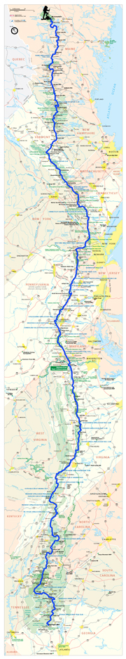
Map
Comments off
Little Roundtop Mountain

Location: Smith Roach Gap, SNP
Miles hiked today: 15.8
Miles from Springer: 888.3
Miles to Katahdin: 1285.7
Elevation: 2620′
We somehow managed not to get poison ivy even though it was everywhere at the campsite we chose last night. We only had a few miles to walk to get to the Loft Mountain wayside (the same one we ate at yesterday on our way to the trail) so we knew we could look forward to some coffee and food. Because this was my dad’s last day on the trail, we wanted to make some good miles today. We had a pick-up time of 4 pm, because we were driving to D.C. and wanted to be able to get settled in.
At Loft Moutain we met a hiker named Jogle, who is from England and is hiking the entire trail. He is having a great time, and is getting a great look at America this way. Everything is so much cheaper here than in England, he says.
We did a lot of walking on the Skyline Drive today, partly because we could make better time on it. We had an arbitrary goal set for ourselves of reaching Swift Run Gap, which marks the end of the southern district of SNP and, more importantly, would mean I wouldn’t need to carry that map when I get back on the trail.
Late in the day we climbed Little Roundtop Mountain. It was not a bad climb, and in no way did it resemble that rocky slope with the same name at Gettysburg. I don’t know what this mountain was named for, and I could not find a Big Roundtop on the map, although there was a Big Flattop Mountain.
We got rained on pretty good, which left our feet soaking wet and not in very good shape for doing big miles. The rain finally stopped and we were able to dry out some, but the next thunderhead was on its way. By 4 pm, my mom called and said she would be a little late. We decided to stop at a pullout that had a little information board with a roof on it, so we could take shelter under it. When she showed up, she had a car full of trail magic, including chicken strips with buffalo sauce, fruit, cheese, soda and all sorts of other things. It was a prodigous trip to D.C. for me, as I ate the whole way.
Comments off
Jackson’s Valley Campaign

Day 80
Location: Doyle River Overlook
Miles hiked today: 11
Miles from Springer: 872.5
Miles to Katahdin: 1,301.5
Elevation: 2,800′
Yet again I am reminded how difficult it is to get going early after any town stop. In this case, it is only the Big Meadows lodge, but it is hard to leave in a timely manner nonetheless. We had a great breakfast, and while packing the car, we ran into my friends 2 Mile and Weatherman. Big Meadows is about an hours drive north of where we left off on the trail, so it was going to take us a little while. Before leaving Big Meadows we stopped at 2 gift shops, one of which was the Byrd visitors center which had a really great museum. It was probably close to 11 am before we ever left Big Meadows On our way back to the trail, we decided to stop for lunch at the Loft Mountain wayside, which is a place where you can order burgers and sandwhiches. We ran into a bunch of hikers there, including Snap and Snack, who had missed the trail magic the day before. It wasn’t near the same as chicken strips would have been, but we gave them some sodas from the cooler.
It was 1 pm before we finally got back on the trail, but we promptly made up for time. We ended up making pretty good miles today, and used the Skyline Drive a lot as it has lots better views. The only problem is that walking on it makes the feet sore, so we kind of mixed it a bit. By the time dinner time came around, there was still plenty of daylight left and we planned to keep hiking, so we decided to stop early for dinner. We were just looking for a place to stop when we came upon an overlook for Brown’s Gap. There was a sign there talking about Stonewall Jackson using the gap in 1862. What a perfect place to stop for dinner! It was framed by a panoramic view of the Shenandoah Valley, with a beautiful golden sun shining through the clouds.
Jackson’s 1862 campaign is one of the most legendary in all of American history, and is still studied the world over today. It was a time of great peril for the Confederacy, when U.S. Grant had just won signal victories out west, the Mississippi Valley was mostly in Union hands, and an assault was being staged on New Orleans. In addition, over 200,000 Union troops threatened Richmond itself. Stonewall Jackson single handedly gave back hope and a chance for success to the Confederacy. He took a ragtag force of 17,000 men, and kept three Union armies busy that numbered three times his strength, marching over 400 miles up and down the Shenandoah Valley. He kept his enemies and even his own subordinates guessing at his next move, and won no less than 5 battles in two months, drawing 40,000 men off of Richmond and keeping Lincoln wondering if Washington itself would be attacked. All of this occurred before catching a train west in time for the defense of Richmond against the hapless George McClellan in the Seven Days Battles.
Brown’s Gap was one of the places Jackson used to cross the Blue Ridge. It was really neat looking at the gap, wondering what it would be like to be one of his “foot cavalry” and climbing this mountain on a forced march. Looking down on the gap, there is no road visible, which is curious because Civil War armies almost always used available roads for movements. However, once we actually passed Brown’s Gap I noticed that there is a fire road. Sure enough, there on the map the fire road is called Brown’s Gap road, and goes all the way over the mountain. It is an amazing thing to wonder that this road still exists, and is probably only in slightly different shape than it was in 1862. There are very few roads in Shenandoah National Park today, but there are plenty of fire roads still in existence. I would bet that the National Park Service did not have to build very many of those, as many roads would have existed from before.
It started to thunder and rain, so we found a camp on a hillside amid lots of poison ivy. We got the tents up just in time for a very short storm, but it blew over and we had a very nice, cool night for sleeping. It is my dad’s last night on the trail, so I’m glad it was such a nice night.
Comments off
")

")
")
")
")
")
")
")
")